By Tierney R. O’Donnell
Sacramento is known for being flat. One of its first monikers was the “City of the Plain”. On a clear day, I can see the Sierra Nevada to the east, the Coastal Range to the west, and even the hazy shapes of the Sutter Buttes to the north and sacred Mount Diablo to the south. These landmarks are comforting to me. Even as a little girl, I took pride in living in the Great Valley, just like Littlefoot in The Land Before Time (1988). To me, the hills and mountains surrounding Sacramento have always felt like encircling and protective arms. Visiting hillier places always makes me grateful for the flat ground of my home town, especially when parallel parking or riding a bike.
Because the valley is such a level plain, when my husband and I moved to the city’s South Side neighborhood, I was curious about a noticeable incline in the street grade near our house. Walking north along Fourth Street, the road rises up as you approach R Street. This is a remnant of a levee that once ran along R Street and formed the southernmost border of the city. Initially built to protect the city from flooding, the levee more often exacerbated matters to the point that angry residents banded together at the turn of the twentieth century to remove it. This swell of civic engagement was the inciting incident that led to the formalization of the neighborhood I now live in and led to future improvements such as the creation of Southside Park.
History of the R Street Levee
Built at the convergence of the Sacramento and American Rivers, the City of Sacramento has always needed levees to deal with flooding. As far back as 1854, the Daily California Statesman newspaper was advertising to “the citizens of the Levee City.”1 The Sacramento Valley Railroad Company built the R Street levee in 1855 after the city passed Ordinance No. 229 granting the railroad right-of-way.2 (I’m not an expert in city governance lingo so I looked it up and learned that an ordinance is a law issued by a local government, like a city.) If you’re in the area, there are several plaques in the sidewalks along R Street3 documenting the history of that district.
I haven’t found specific information on how high the R Street levee was compared to the street level. I imagine it was maybe ten to twelve feet high with enough of a slope that horses and wagons and pedestrians could scramble up the sides of the levee where it intersected with the numbered streets that run perpendicular to R Street. Maybe the levee was only six feet high? If any readers have information on the height of Sacramento’s nineteenth century levees please contact me!
The R Street levee was contentious from the beginning. Not even a full year after the railroad’s initial run along the levee, a concerned citizen wrote to The Sacramento Age newspaper in 1856 under the pseudonym “Forty-Niner” to express their concerns. The writer contended that the levee had done the opposite of protect the city from flood waters. Instead, they wrote:
during the rains of winter [the levee] has served to dam up the waters that would, but for such obstruction, naturally have found an outlet to the low grounds in the vicinity—causing them, during the summer months to stagnate and become offensive, thereby creating sickness, depreciating the value of property, and other concomitant evils, of which the people in that neighborhood have just cause to complain…4
In January 1850—one year after gold was discovered and nine months before California became a state—heavy rains caused both the Sacramento and American Rivers to flood the city. The streets were covered in six feet of water. More devastating and levee-breaking floods followed in 1852 and 1861-62. The photograph below is from the storm which began on Christmas Eve 1861 and continued for 43 days into 1862.5 Rather than protect the city, the R Street levee trapped the floodwaters inside the downtown area.6 Parts of the levee even had to be removed to allow the water to drain out. The Forty-Niner’s warnings had become the city’s reality.

Beyond the Pale
As the years went by, not only was the R Street levee occasionally an exacerbation to flooding rather than a deterrent, it also became redundant. In 1878, an additional levee was built further south at Y Street—what is now Broadway. With this newer levee in place, citizens argued what was the point maintaining the levee on R Street which segreated the entire southern area from the rest of the city?
For the residents of what was known as the “south side” of the city, the R Street levee created a physical as well as a psychological barrier. Though the original 1848 map of the city spans the alphabet from A all the way to Y Street, due to the levee and the railroad, everything south of R Street was considered beyond the borders of the city. The south side was literally “beyond the pale.” This phrase feels especially appropriate since some of the earlier immigrants to the south side during the Gold Rush were Irish and “the pale” is a reference to the border which deliniated English-controlled land in fifteenth century Ireland. The name “the pale” comes from the stakes that marked the boundary, from the Latin word palus, meaning “stake.”8 In nineteenth century Sacramento, the levee and railroad tracks at R Street formed a border between the city and the wild marshy lands beyond. Here there be tygers.
Today, if I want to travel from the South Side neighborhood to the downtown core, it’s a leisurely stroll along level streets with paved sidewalks. Prior to 1903, I would have had to trek up and over a levee topped by an active railroad track. I imagine having to hike up my skirts to climb the levee slope, cautiously looking both ways at the summit to see if a locomotive was barreling down the track. It might have felt like entering a different city after reaching the other side.
The R Street levee also formed a barrier in the minds of city officials. South of the levee, their feelings of jurisdictional responsibility seemed to wane. P. H. Hanrahan complained in 1901 that he got no traction from city officials when he complained about the odors arising from slaughter houses located south of the city. 9 The railroad running along the levee was a nuisance as well. D. Gardner complained of screeching locomotives disturbing the peace and quiet of the surrounding neighborhoods.10 Today, I can hear the train whistles from the embarcadero in Old Sacramento fourteen blocks away (about one mile as the crow flies). I can’t imagine the noise it would make a mere two blocks away.
By 1901, the residents of the city’s south side had had enough.
Forming the Improvement Association
On Friday, September 27, 1901, residents of the city’s south side gathered at a hall on Tenth and S Streets to form the South Side Improvement Association. (After eleven years working for the State, I will resist the temptation to use an acronym and instead will paraphrase with “the Association”.) About 200 individuals, made up of property-holders and residents of the area south of Q Street and west of Twentieth Street, signed the agreement to form the Association. They outlined goals of improving streets, alleys, and sidewalks, constructing sewers, and filling in low lots. But the main impetus for the gathering was to lower the level of R Street to the official city grade.11
Commissioner of Public Works, Frank D. Ryan, called the meeting to order and was elected Chairman of the Association.12 Ryan was an attorney and, back in 1882, had been the youngest member of the California State Assembly at twenty-three years old.13 While Frank D. Ryan was born in Sacramento, his father, John C. Ryan, was born in Ireland and came to California in 1852. Frank must have inherited his passion for civic improvement from his father who was a member of the city’s Board of Trustees in the 1880s and served two years as Superintendent of Streets.14 I wonder if Frank’s dedication to removing the R Street levee was influenced by a past family experience when, during a flood, his father had been “forced to break a hole through the roof of his cottage, by means of which he was able to pass his family into a boat, and thence remove them to a place of safety.”15
To get a better idea of the location we’re talking about, below are some maps of what was considered the south side when the Association was first formed versus what it is today. First is an image of the 1895 Sanborn Fire Insurance Map highlighting the represented area and with an arrow indicating the railroad tracks along the R Street levee. When the Association was formed in 1901, the south side encompassed the portion of the city south of Q Street and west of Twentieth Street. This was an area of roughly 200 blocks which “paid fully one-quarter of the taxes of the city”.16 In comparison, the second image shows a map of the present boundaries of the South Side Historic District. The present area is smaller, encompassing the blocks south of S Street to W Street, and west from Sixteenth Street to Third Street.


Allies and Enemies
The South Side Improvement Association had to appeal to the city’s Board of Trustees to lower the R Street levee. Too bad Frank D. Ryan’s father was no longer serving on the Board to give them a friendly vote. It would be up to the Board of Trustees and the officials of the Southern Pacific Railroad Company to enact the Association’s desired outcomes.19 The Association did have an ally on the Board: James B. Devine. Devine was an attorney and shared a law office with Frank D. Ryan. Like Ryan, Devine was a native Sacramentan and was known for his “scintillating humor”.20 He was “a keen observer of human nature” who loved “to lunge the rapier of his sarcasm into the foibles and the shams of others.”21
James B. Devine expressed his support for lowering the R Street levee at a Board of Trustees meeting on December 2, 1901. He called the railroad “a curse to this city” and said “he would like to force the Railroad Company to have a man stationed at every street crossing to save the lives of people who were compelled to cross the tracks.”22 While Devine assured the Association that the newly-elected Board was “pledged to the advancement of the city” and that “the section south of R Street would be included in the general scheme of advancement”23 the way forward was not completely assured.
The Sacramento Chamber of Commerce opposed the aims of the Association.24 I confess, Civics class in high school was a few years ago so I had to look it up to determine that a Chamber of Commerce is an organization of local businesses that can’t make laws but advocates for policies that support its members’ interests.25 My main association with a Chamber of Commerce is Elvis serenading bathing beauties in Girl Happy (1965). In the movie, it’s spring break and everyone is enjoying themselves “courtesy of the Fort Lauderdale Chamber of Commerce”. The song is a delight and I highly recommend looking it up. But I digress!
While Trustee James B. Devine supported the Association’s goal of lowering the R Street levee, his compatriot, Trustee Dr. Franklin F. Tebbets, opposed it. Tebbets was a dentist and, two years after these events, would die of toxaemia due to ptomaine poisoning (an old term for food poisoning) from eating sea crabs at a San Francisco restaurant.26 However, in 1902, Tebbets was lively, verbally sparring with Devine and calling the south side of the city “lowlands, the only improvement to which had been made by the Chinese gardeners.”27 With industrialist fervor, Tebbets said, “We want more chimneys, pipes and smokestacks here”. 28
There were more saucy exchanges—saucy for the early 1900s—over the issue of the R Street levee in public meetings and in the newspapers. In a paper read aloud at a Chamber of Commerce banquet on February 12, 1902, Valentine S. McClatchy accused the South Side Improvement Association of being a private organization heaping “personal abuse” on the Chamber.29 (I think anyone with the first name of Valentine should think twice before throwing insults.) At a later meeting of the Association, Thomas Fox countered that the Association was “not a private organization, but as public a body as the Chamber of Commerce with probably not as ponderous a name.”30 Since he was on the subject of names, Fox really missed an opportunity to note that, two days after McClatchy’s paper was read, it had been…Valentine’s Day.
Mr. Hughes, Tear Down This Levee
The Association’s ambitions ran into a minor hiccup when the Superior Court awarded title to the city’s northeast levee to Daniel McCarty.31 McCarty had made the bold move of building a fence across the levee, which he claimed was on his land, and forcing trains to stop and open a gate before proceeding.32 There was some uncertainty whether the Southern Pacific Railroad Company would continue their support for lowering the R Street levee if the northeast levee continued to be tangled up in legal issues. But on June 6, 1902, Thomas Fox telephoned The Sacramento Bee that there was occasion for jubilation. Representatives from the Association, the City, and the Southern Pacific Railroad Company had met to discuss plans for lowering the R Street levee.33
At a cost of $11,974.52—approximately equivalent to $437,430.58 in 2025 dollars—the Board of Trustees awarded John Hughes the contract for the work of lowering the levee.34 Work began on September 22, 1902 with a force of men clearing the embankment of weeds.35 Workers were paid $2.50 a day36 (about $91.33 a day in 2025). Hughes was a savvy businessman. Not only did he charge the city to haul away the earth, he also sold the sediment from the levee to interested buyers for an additional fee.37 The work was to be completed within 120 days of executing the contract; around mid-January 1903. As anyone who has ever had construction work done knows, things take longer than initially planned. Contractor John Hughs received multiple extensions for lowering the levee. By April 1903, Mayor George H. Clark mentioned at a Board of Trustees meeting that the lowering of the R Street levee was nearing completion.38
I wish I could say that I found evidence of a grand opening ceremony to mark the completion of lowering the R Street levee. I wanted there to be ribbon-cutting and parades and speeches touting the Association’s triumph. But human behavior doesn’t change much. We’re more likely to focus on when things go wrong versus when things go right (e.g. the vast majority of reviews on Yelp or Google). At some point in the months between April and July 1903, work was completed on lowering the R Street levee to the official city grade. The levee that had functioned for so many years as a wall “dividing the city from desolate places beyond”39 had come down. While there is no recorded fanfare, I imagine it was no small thing for the residents of the south side.
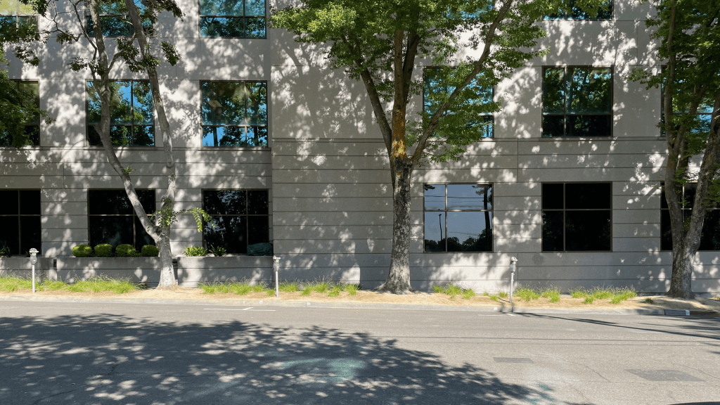
Below are two pictures depicting R Street after the levee had been lowered. The first is from 1941 and the second from 2025.


In July 1903, The Sacramento Bee wrote:
the section south of the R-Street levee today is in a different condition from that of a year or two ago.
The lowering of the R-Street levee to the city grade has removed a barrier which had long made the southern section a thing apart. But now attractive homes are being built there, and streets improved.41
Having achieved its main goal, the South Side Improvement Association turned its sights to future improvements: opening up public streets that had been used as private vegetable gardens, running a streetcar down T Street, and building Southside Park.
As I walk the streets of my South Side neighborhood, I wish I had the ability to see backward in time. I wouldn’t want to physically travel through time. I don’t want a situation like in Ray Bradbury’s short story “A Sound of Thunder” (1952) where I accidentally step on a butterfly and change the course of history (spoiler alert!). I just wish I could stand on Fourth Street looking north towards R Street and rewind/fast-forward/rewind to see the levee go up/down, up/down. Since I don’t have that super power—and skunks are more plentiful around here than TARDIS-es or radioactive spiders—researching this blog and learning the stories of the places I know and love will have to do.
Bibliography
- “Metropolitan.” Daily California Statesman. November 13, 1854. https://www.newspapers.com/article/daily-california-statesman/175984870/. ↩︎
- “City Ordinances. No. 229.” Sacramento Daily Union. March 6, 1855. https://cdnc.ucr.edu/?a=d&d=SDU18550306.2.17.6. ↩︎
- Ruppenstein, Andrew. “City’s First Southern Flood Levee”. The Historical Marker Database. July 21, 2020. https://www.hmdb.org/m.asp?m=153302. ↩︎
- “For the Spirit of the Age.” The Sacramento Age. May 8, 1856. https://www.newspapers.com/article/the-sacramento-age/146337325/. ↩︎
- Dettinger, M. D., and B. L. Ingram. 2013. “The Coming Megafloods.” Scientific American, 308(1), 64-71. https://cw3e.ucsd.edu/wp-content/uploads/2013/10/Dettinger_Ingram_sciam13.pdf. ↩︎
- “City of Sacramento, R Street Historic District Plan.” R Street Historic District Plan . ↩︎
- Center for Sacramento History, Eugene Hepting Collection, 1985/024/1612. https://sacramento.pastperfectonline.com/photo/9D14884C-BD35-4726-ACF7-826574170645. ↩︎
- Jennings, Ken. 2016. “What ‘Beyond the Pale’ Actually Means”. Condé Nast Traveler. https://www.cntraveler.com/story/what-beyond-the-pale-actually-means. ↩︎
- “For the Improvement of the South Side.” The Sacramento Bee. September 28, 1901. https://www.newspapers.com/article/the-sacramento-bee/146337864/. ↩︎
- “For the Improvement of the South Side.” The Sacramento Bee. September 28, 1901. https://www.newspapers.com/article/the-sacramento-bee/146337864/. ↩︎
- “For the Improvement of the South Side.” The Sacramento Bee. September 28, 1901. https://www.newspapers.com/article/the-sacramento-bee/146337864/. ↩︎
- “For the Improvement of the South Side.” The Sacramento Bee. September 28, 1901. https://www.newspapers.com/article/the-sacramento-bee/146337864/. ↩︎
- Vassar, Alex and Meyers, Shane. “Election History for the State of California.” https://www.joincalifornia.com/candidate/7467. ↩︎
- Davis, Winfield J. 1890. An Illustrated History of Sacramento County California. The Lewis Publishing Company. https://lccn.loc.gov/02002234. ↩︎
- Davis, Winfield J. 1890. An Illustrated History of Sacramento County California. The Lewis Publishing Company. https://lccn.loc.gov/02002234. ↩︎
- “Devine Casts the Gauntlet.” The Sacramento Bee. January 7, 1902. https://www.newspapers.com/article/the-sacramento-bee/146338355/. ↩︎
- Sanborn Fire Insurance Map from Sacramento, Sacramento County, California. Sanborn Map Company, 1895. Map. https://www.loc.gov/item/sanborn00799_001/. ↩︎
- “City of Sacramento, South Side Historic District Plan.” South Side Historic District Plan. ↩︎
- “For the Improvement of the South Side.” The Sacramento Bee. September 28, 1901. https://www.newspapers.com/article/the-sacramento-bee/146337864/. ↩︎
- “California Bar Loses One of Its Ablest Men.” The Sacramento Bee. December 17, 1909. https://www.newspapers.com/article/the-sacramento-bee/176311354/. ↩︎
- “California Bar Loses One of Its Ablest Men.” The Sacramento Bee. December 17, 1909. https://www.newspapers.com/article/the-sacramento-bee/176311354/. ↩︎
- “South-Side Association Opposes a Spur Track.” The Sacramento Bee. December 3, 1901. https://www.newspapers.com/article/the-sacramento-bee/146190020/ ↩︎
- “Citizens Further Protest Against Railroad Barrier.” The Sacramento Bee. January 9, 1902. https://www.newspapers.com/article/the-sacramento-bee/146230983/. ↩︎
- “Citizens Further Protest Against Railroad Barrier.” The Sacramento Bee. January 9, 1902. https://www.newspapers.com/article/the-sacramento-bee/146230983/. ↩︎
- Johnson, Jamie. 2025. “What Is a Chamber of Commerce, and Why Should You Join One?” U.S. Chamber of Commerce. https://www.uschamber.com/co/start/strategy/what-is-a-chamber-of-commerce. ↩︎
- “Sudden Passing of City Trustee Tebbets.” The Sacramento Bee. September 5, 1904. https://www.newspapers.com/article/the-sacramento-bee/176357354/. ↩︎
- “Devine Casts the Gauntlet.” The Sacramento Bee. January 7, 1902. https://www.newspapers.com/article/the-sacramento-bee/146338355/. ↩︎
- “Devine Casts the Gauntlet.” The Sacramento Bee. January 7, 1902. https://www.newspapers.com/article/the-sacramento-bee/146338355/. ↩︎
- “What is the Matter with Sacramento?” The Sacramento Bee. February 13, 1902. https://www.newspapers.com/article/the-sacramento-bee/176359158/. ↩︎
- “South Side Club Hopeful.” The Sacramento Bee. March 6, 1902. https://www.newspapers.com/article/the-sacramento-bee/175789484/. ↩︎
- “Will Appeal Levee Case.” The Sacramento Bee. May 27, 1902. https://www.newspapers.com/article/the-sacramento-bee/146338950/. ↩︎
- “Built a Fence Across Track.” The Sacramento Bee. December 22, 1900. https://www.newspapers.com/article/the-sacramento-bee/146337742/. ↩︎
- “Down Goes R-Street Levee.” The Sacramento Bee. June 6, 1902. https://www.newspapers.com/article/the-sacramento-bee/146338991/. ↩︎
- “Down Comes the R-Street Levee.” The Sacramento Bee. September 9, 1902. https://www.newspapers.com/article/the-sacramento-bee/146361344/. ↩︎
- “Cutting Down R-Street Levee.” The Sacramento Bee. September 22, 1902. https://www.newspapers.com/article/the-sacramento-bee/146390029/. ↩︎
- “Union of Street Laborers.” The Sacramento Bee. February 3, 1903. https://www.newspapers.com/article/the-sacramento-bee/176882825/. ↩︎
- “Late for Classification.” The Sacramento Bee. November 17, 1902. https://www.newspapers.com/article/the-sacramento-bee/146392360/. ↩︎
- “Annual Message of the Mayor.” The Sacramento Bee. April 14, 1903. https://www.newspapers.com/article/the-sacramento-bee/176878265/. ↩︎
- “Miles of Public Streets Used for Private Gardens.” The Sacramento Bee. June 20, 1903. https://www.newspapers.com/article/the-sacramento-bee/176813008/. ↩︎
- Center for Sacramento History, Eugene Hepting Collection, 1985-024-4801. https://sacramento.pastperfectonline.com/photo/6326DE9D-4F42-4955-8A8F-221204052767. ↩︎
- “How Much Longer is This Misuse of Public Streets to Continue?” The Sacramento Bee. July 2, 1903. https://www.newspapers.com/article/the-sacramento-bee/146394096/. ↩︎